Lancaster to Somerville
Sunday 10 August 1997
I start at about 5am. Before leaving the Franklin & Marshall campus, I
head for the centre of Hartman Green with a can of Veryfine, and offer a final
toast of the summer to CTYers past, present, and future, wherever they may be
and whatever they may call themselves. Then, after circling Sticks and Stones,
I head north past Hensel Hall and onto College Avenue. I turn right onto
Harrisburg Pike, which merges into James Street. At the cemetery, James Street
veers left and becomes Park Avenue. I turn right onto Frederick Street, right
onto Marshall Street, and left onto the 23 (New Holland Pike).
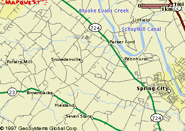
I continue on the 23 east out of Lancaster County. Between Lancaster and Leola
I'm climbing out of the Landis Valley, so it's mostly uphill, but not very
steep. I pass a few miles south of French Creek State Park in Warwick
Township, and pass a county park on my right. I cross the 100 in Bucktown and
continue into Brownbacks. Shortly after
passing Brownback's Church on the right, I turn left onto Bethel Church Road.
This is a tiny, county road, and it's ironic that I find myself on it on the
way to New York City. The City still isn't much more than an idea, out here.
In Parker Ford, Bethel Church Road crosses the 724 (Old Schuylkill Road) and
becomes Linfield Road. Linfield Road curves right and crosses a cantilever
bridge over the Schuylkill Canal. Toward the west, two cooling towers are
visible on the northern bank of the canal. I cross a bridge over a railroad
and enter Linfield, a small town full of brightly painted Victorian houses and
trimmed hedges. People must commute from here into nearby Pottstown. Linfield
Road becomes Linfield Trappe Road, and then ends at a 'T' intersection with
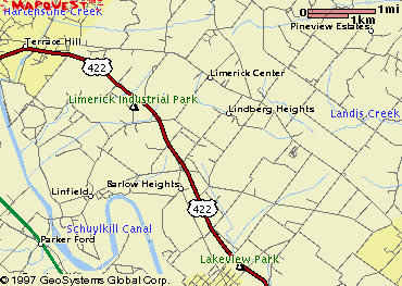
Lewis Road, opposite an on-ramp for the 422 east. I turn left (north) onto
Lewis Road, heading toward Limerick, and pass
under the 422. Lewis Road ends in a 'T' intersection with West Ridge Pike,
where I turn right. After the turn, there are a Sunoco and a church on the
left. At the church, I turn left onto Limerick Road.
On Limerick Road, a group from the
Bicycle Club of Philadelphia
led by Jeff Reardon catches up with me. They're on a ride up the Perkiomen
Creek into Montgomery County. They turn left onto Hackle Road, and I continue
straight and then turn sharply right to continue on Limerick Road. (If you
miss this turn and continue straight, you'll find yourself on Mile Run Road.)
It's rather visible; there's a sign on the corner that says 'stop except right
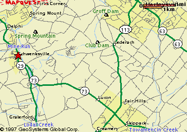
turns'. In Schwenksville, Limerick Road
becomes Perkiomen Avenue and descends a steep hill. At a 'T' intersection with
the 29 (Main Street), I turn right. Shortly thereafter, I turn left onto the
the 73 east crossing a bridge over Perkiomen Creek. Immediately on the north
side of the creek, I turn left onto Haldeman Road as the 73 curves right.
There are many people out biking today. I encounter one of them while I'm
stopped to check my map. He advises me to turn right onto Bergey Mill Road at
another 'T' intersection where Haldeman Road turns sharply left. Bergey Mill
Road climbs a long, steep hill and ends at Cross Road, where I turn left. From
Cross Road I turn left onto the 113 north. It's about 11 o'clock, and I'm
halfway to New Jersey.
The 113 takes me almost all the way to New Jersey, but there's one more ridge
to cross between the end of the 113 and the Delaware River. The 113 ends at
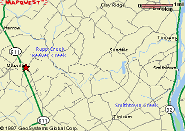
the 611 a couple of miles past Bedminster. At about 1.30pm, I cross the 611
onto Hollow Horn Road, a small, county road. At a covered bridge 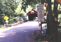 that carries
Hollow Horn Road across a creek, I run into a couple of bicyclists out for a
Sunday ride, and we talk for a few minutes. Just past the bridge, Hollow Horn
Road turns sharply right. (If you miss this turn, you'll find yourself on
Cafferty Road, which leads past a small airport where gliders and powered
airplanes operate. At the north end of the airport, turn right onto
Headquarters Road, and follow the directions below.) At a 'T' intersection
with Headquarters Road, turn right. The road follows a mostly dry creek bed
before turning sharply left. (If you miss this turn, you'll find yourself on
Tinicum Road, which should also lead eventually to the Delaware, though at a
point farther south.) At the Enwinna post office,
Headquarters Road turns sharply right. It ends shortly thereafter, at the 32
(River Road), which runs along the Delaware River. The hilly terrain since the
end of the 113 has been tough going, although that's been mitigated by the cool
shade of the forest. I'm looking forward to the flat land along the river.
At Tinicum Park, there's easy access to the river, and I stop for a swim to cool
and to get the dirt from the road off my skin. There's a lot of activity on
the river: canoes from a summer camp, families swimming, people tubing. After
a mile or two, I turn right and cross a bridge over the Delaware and into
Frenchtown, New Jersey.
that carries
Hollow Horn Road across a creek, I run into a couple of bicyclists out for a
Sunday ride, and we talk for a few minutes. Just past the bridge, Hollow Horn
Road turns sharply right. (If you miss this turn, you'll find yourself on
Cafferty Road, which leads past a small airport where gliders and powered
airplanes operate. At the north end of the airport, turn right onto
Headquarters Road, and follow the directions below.) At a 'T' intersection
with Headquarters Road, turn right. The road follows a mostly dry creek bed
before turning sharply left. (If you miss this turn, you'll find yourself on
Tinicum Road, which should also lead eventually to the Delaware, though at a
point farther south.) At the Enwinna post office,
Headquarters Road turns sharply right. It ends shortly thereafter, at the 32
(River Road), which runs along the Delaware River. The hilly terrain since the
end of the 113 has been tough going, although that's been mitigated by the cool
shade of the forest. I'm looking forward to the flat land along the river.
At Tinicum Park, there's easy access to the river, and I stop for a swim to cool
and to get the dirt from the road off my skin. There's a lot of activity on
the river: canoes from a summer camp, families swimming, people tubing. After
a mile or two, I turn right and cross a bridge over the Delaware and into
Frenchtown, New Jersey.
I curve left through the centre of town and then turn right, following a sign
for the 12. The 12 ascends a long hill on the New Jersey side of the Delaware
Valley, and continues to the 202 just south of Flemington. I stop here for a
more substantial meal. I continue on the 202 to
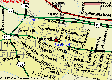
Somerville, where I take the 28 into town.
I've come about a hundred miles and have another thirty or so to go, but I'm
having difficulty persuading my legs to move. Weighing the alternatives, I
decide to take a commuter train the rest of the way into the City. I turn
right onto South Bridge Road, which leads to the Somerville train station, and
put myself and the bicycle on the next inbound train. (Note: New Jersey
Transit requires a permit in order to allow a bicycle on a train. These are
free, but must be applied for in advance, during business hours, at Penn
Station in Newark or New York.)
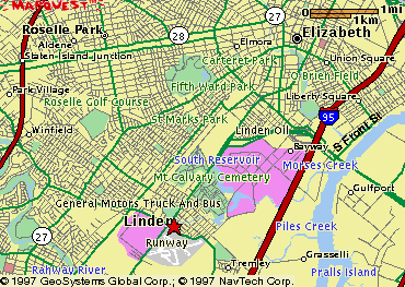
(Hardcore riders may want to continue on the 28 all the way to
Linden, where one can take any of several routes
into the City.)