In June 2002 I was due to participate in a summer institute on the island of Berder, just west of Vannes on the south coast of Brittany. I decided to cycle from London to Berder, via the cross-channel ferry. Since the ferry departure from the English side is in the evening, one can sleep on the boat and have the whole day ahead in France, which of course works very well for a cycling trip. Following are the directions that I've put together for this trip, as well as a few images and some maps. In addition to these directions, you'll need good maps. I used a London A-Z, Ordnance Survey Landranger sheets 187, 186, 197, and 196, and IGN green sheets 16 and 15. In the UK, you can buy these from Stanfords or any other good map shop.
From Cobham near the M25, pass through Hatchford Park, Martyr's Green, and Ockham. At Church End, just after the road joins the B2039, turn left. Then take the next right into Ripley. In Ripley, turn left onto the B2215. In Send Marsh, turn right onto the B368, and follow the B368 when it turns left. Go straight across the A247 and onto an unclassified road. In Send Grove, cross another road and continue to a church. Walk your bicycle along the footpath at the end of the road, crossing a small branch of the River Wey and then the Wey itself, till you reach a dirt road on a farm. From this road, turn left and then left again towards Jacobs Well. Turn right at Jacobs Well, left onto a short length of the A320, and right at the roundabout. Cross under a railway and then immediately turn left onto a bridleway through the woods. (This turn is easy to miss - it's immediately after the railway.) Continue straight onto an unclassified road. At the next major intersection, turn right. Cross the A322, pass a road to the left, then turn left towards the A323 roundabout. From the roundabout, follow the unclassified road into Wood Street Village, then take the cycle track to the left (easy to miss). Follow the cycle route (sections of road and byway) through Flexford, Ash Green, and Tongham. After crossing the A331, passing a lake on the left and a block of flats on the right, and curving rightwards, turn left onto the B3208 and then almost immediately left onto an unclassified road. Cross over the A31, then turn right. Follow the bridleway just where the road merges into the A31. Turn right onto a road across the River Wey, then turn left. Cross the B3001 and the A287, turn left, right, right, left, left, right. Pass straight through Rowledge and into the Alice Holt Forest. At a farm enclosed by the forest, you will need to heft your cycle over two locked gates. At the edge of the forest, turn left onto the A325 through Bordon and then continue straight at a roundabout onto an unclassified road into Greatham. This road merges into the B3006 towards Liss. Cross the A3. In West Liss, bear right onto an unclassified road which parallels the A3. Turn left across the River Rother and the railway, turn right, turn right, cross the railway, turn left parallelling the A3, bear right, and cross the A272 onto the B2070 through Petersfield. At the far edge of town, turn left at a phone box onto an unclassified road. Go straight through Buriton, cross under the railway, pass under a high-voltage transmission line, cross over the railway and turn right, cross over the railway twice more. After entering Rowlands Castle, bear left into Red Hill, then turn half-left onto the B2149 into Havant. At the roundabout just before the railway station, turn right onto the B2177. Bear left at the roundabout onto the A2030. You will enter Cosham, a neighbourhood in the north of Portsmouth. There are signs for the ferry port - ignore them; they lead to motorways. Just after the second church on the right, and one block before a roundabout, turn left. Bear left to avoid being fed into the A3. Turn right, across the A27. When you can go no farther, turn left onto the A288 and then immediately right onto the A2047. After passing the second church on the left, take the next major road to the right, go straight through a roundabout, and follow the signs to the ferry terminal.
| |
 |  |
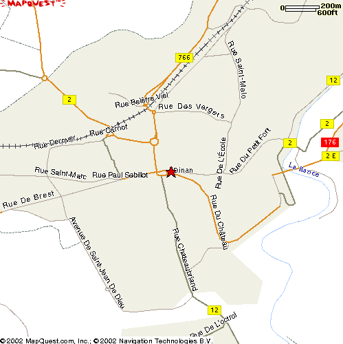
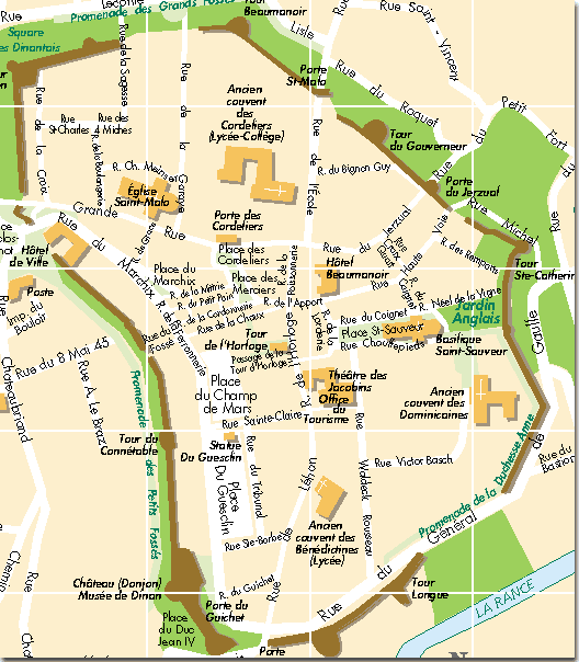
After passing through the centre of Dinan, bear left onto the Rue de Brest. You are on the D.794. Go straight through the roundabouts towards the N176 motorway. Just before the road merges into the N176, turn left onto the D.61 towards Trélivan. Pass the Dinan-Trélivan airport on the right. Follow the D.61 through Trélivan, Trébédan, and Languédias. In Trédias, follow the signs towards Broons, turning right and then left onto the D.19. Pass under a railway and under the N12 motorway, then immediately turn left onto the D.712, following the sign for Broons. Bear left outside Broons and follow the signs for Éréac onto the D.793. Broons is a good place to stop for lunch; the centre of town, which you will pass through on this route, has several restaurants.
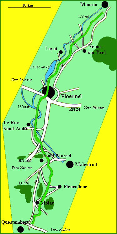
On the D.793, pass the Bois de Broons on the left. Immediately after exiting the Bois de Broons, the D.793 turns sharply right as a smaller road continues straight. Immediately after making this right turn, turn left onto the D.52. Follow the D.52 through la Ville Odie, across the D.76, through la Ville Colliaux, across the N164 and the D.66, through Grénédan, and across the D.258. The D.52 now becomes the D.307. Continue on the D.307 into Mauron.
 |
| All pictures of the Morbihan rail trail kindly provided by François Camper |
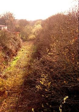
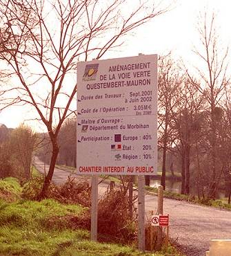
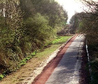
The Morbihan rail trail (`voie verte') is currently (June 2002) under construction and will run from Mauron at its north end to Questembert in the south. Eventually it will be possible to turn left onto the D.16 and then right onto the voie verte. Currently, though, the rails and overgrowth haven't yet been removed from the northernmost section of the trail, and so one must take a longer route over some hilly terrain. (It is also possible to follow the D.16 east to the D.766 and to cycle south along the D.766; however I do not recommend this since motorised traffic on this segment of the D.766 is heavy.)
 While the voie verte is closed, take the D.167 through le Plessis, la Ville
Juhel, and through le Bois de la Roche. At Kernéant, turn left down
the steep hill towards la Vallée. Continue straight past la
Vallée to a T intersection, and turn left. Take the next right, pass
through Trégadon, and turn left before you would enter la Grée
Trégadon. Go straight through the next intersection. In
Tréguier, turn left. As the road begins to curve right, there will be
two restricted access roads to the Ploërmel-Loyat airport on your left.
At the T intersection, turn left onto the D.13 into Loyat. There is a
campground here, just after you cross the river, if you feel like stopping.
Immediately after crossing the river, turn right onto the voie verte. (Here
you rejoin the route that you would have taken from Mauron had the entire
length of the voie verte been open.)
While the voie verte is closed, take the D.167 through le Plessis, la Ville
Juhel, and through le Bois de la Roche. At Kernéant, turn left down
the steep hill towards la Vallée. Continue straight past la
Vallée to a T intersection, and turn left. Take the next right, pass
through Trégadon, and turn left before you would enter la Grée
Trégadon. Go straight through the next intersection. In
Tréguier, turn left. As the road begins to curve right, there will be
two restricted access roads to the Ploërmel-Loyat airport on your left.
At the T intersection, turn left onto the D.13 into Loyat. There is a
campground here, just after you cross the river, if you feel like stopping.
Immediately after crossing the river, turn right onto the voie verte. (Here
you rejoin the route that you would have taken from Mauron had the entire
length of the voie verte been open.)
 |  |
Follow the D.766 onwards to Elven, crossing under the N166 motorway twice. There is a cycle shop at the far edge of Elven, if you need one. A few miles past Elven, on the right, is a fifteenth-century castle which is open from 14.30.
 After Elven, cross over a railway. At the roundabout shortly thereafter,
do not follow the sign for Vannes; it leads onto the N166 motorway.
Instead, follow signs for Kerboulard and Saint-Avé on the D.775. Pass
through Kerboulard and Cosqueric. At the roundabout, with the N166 motorway
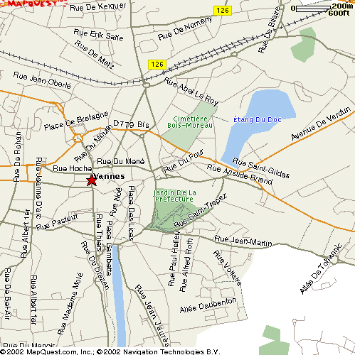
again on your left, follow the C.110 (Avenue de Verdun, becoming Rue du Mal
Leclerc) into Vannes. Continue straight on this road till you can't go any
farther, then turn left onto Rue Francis Decker. The Jardin de la
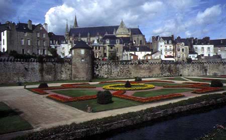
Préfecture will be on your left, and the old walled city of Vannes on
your right. At the gate, walk your cycle into the old city. On Saturdays
there is an open-air market here, where you can buy good bread, cheese, and
fruit. Up the hill to your right is the Chateau Gaillard, a museum of the
archaeology of the Morbihan region, open from 10.00.
After Elven, cross over a railway. At the roundabout shortly thereafter,
do not follow the sign for Vannes; it leads onto the N166 motorway.
Instead, follow signs for Kerboulard and Saint-Avé on the D.775. Pass
through Kerboulard and Cosqueric. At the roundabout, with the N166 motorway
again on your left, follow the C.110 (Avenue de Verdun, becoming Rue du Mal
Leclerc) into Vannes. Continue straight on this road till you can't go any
farther, then turn left onto Rue Francis Decker. The Jardin de la
Préfecture will be on your left, and the old walled city of Vannes on
your right. At the gate, walk your cycle into the old city. On Saturdays
there is an open-air market here, where you can buy good bread, cheese, and
fruit. Up the hill to your right is the Chateau Gaillard, a museum of the
archaeology of the Morbihan region, open from 10.00.
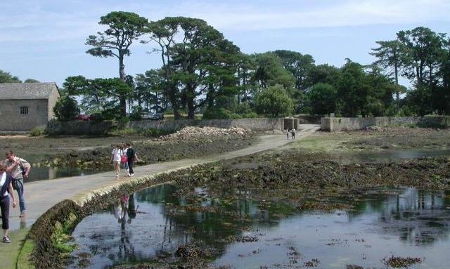
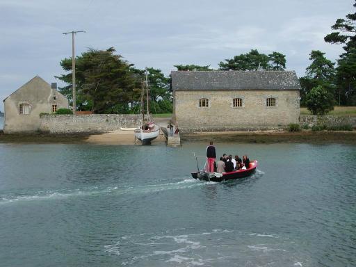
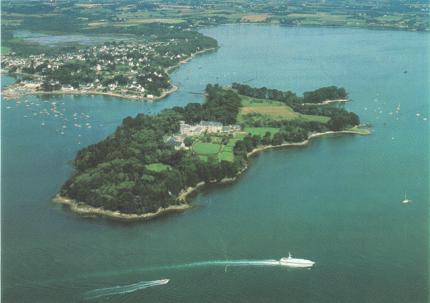
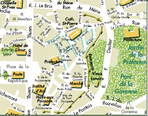
After passing straight through the Market, cross Rue Thiers and continue behind the post office, eventually crossing Rue Jeanne d'Arc. Rue Pasteur is the street that you want, but it's one-way. So you must take the road just north of Rue Pasteur which joins up with it at the edge of the city centre. You are now on the D.101 (Rue Jerome d'Arradon, becoming Boulevard des Iles) towards Baden. Pass through La Salette, Loqueltas, Kerbourleven, and le Moustoir. At the roundabout after le Moustoir, turn left onto the D.316 towards Larmor-Baden. In Larmor-Baden, follow the signs (keep turning left) to Ile Berder. Berder is accessible by road only when the tide is low, so be prepared to wait a few hours if you've not checked the tides in advance.
 |  |
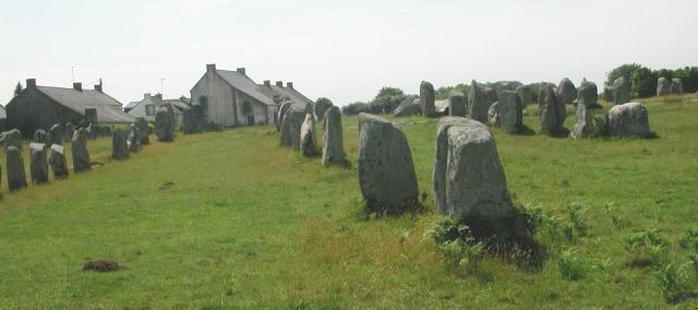
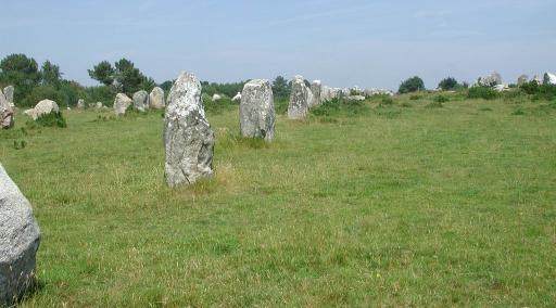
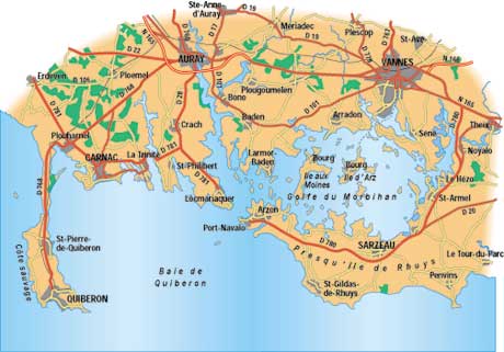
An interesting side trip within the Morbihan region is the megalithic alignments near Carnac. These can be reached by following the D.316 west from Larmor-Baden to the D.101 at Baden, and then continuing to the city of Auray and port of Saint Goustain. After crossing the Rivière d'Auray, follow the D.28 south and east to Carnac. The alignments are a short distance north of Carnac on the D.119, and after visiting them you can circle back to Auray by continuing north on the D.119 to the D.768.
 |  |
 |  |
 |  |
 |  |