New York to Baltimore
Wednesday-Thursday 25-26 June 1997
180 miles, five states, three major universities, two days
On Wednesday and Thursday, 25-26 June 1997, I bicycled from New York City to
Baltimore through high humidity, triple-digit temperatures, and New Jersey.
I started from Staten Island, near the ferry terminal in Saint George, at about
3.30am. Leaving early let me beat the heat of the day, and also some heat of a
different sort on the Goethals bridge. The Hudson River crossings in and out
of the city are not bicycle-friendly. In fact, the only legit ways to get
across are to bike all the way to the north end of Manhattan and take the
George Washington Bridge, or to get a PATH bike pass and take the train from
the World Trade Center. As neither of these options is attractive when
starting from Staten Island, I decided to sneak across the Goethals Bridge
under cover of the night.
Although there are walkways on the Goethals that have in the past been open to
bicycle traffic, at the moment the walkways on both sides of the bridge are
closed. The one on the south side leads into a construction site, but the one
on the north side is secured only by a locked gate, which can be jumped. I
recommend walking the bicycle on the bridge, since the walkway is narrow and
cluttered with debris.
The Goethals is perennially under construction, but in between the signs and
the equipment there's still room on the sidewalk. I pass a lone construction
worker, but like most New Yorkers, he seems not to mind what I'm doing as long
as it doesn't get in his way.
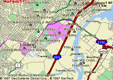
At the New Jersey side of the bridge I take the Bayway to a roundabout and
get on route 1 south, then dodge west on Stiles Road to Elizabeth Avenue at
the northern edge of the General Motors truck and bus plant at Linden. In
Rahway, Elizabeth Avenue ends in a 'T' intersection facing a Masonic temple.
I turn left and keep going till I arrive at another 'T' intersection, where
I turn right. This road leads to the 27, where I turn left and head south.
Soon after this, the 27 takes a half right and begins following a set
of railroad tracks which are on the left, leading into Woodbridge.
I pass through Menlo Park, where the name of Thomas Edison is everywhere, and
into Metuchen, which seems rather upscale and suburban. In Metuchen there's a
'DO NOT ENTER' sign straight ahead, and a smaller sign that says
'ROUTE 27 4 BLOCKS RIGHT'. You have to make sure that when you take that dodge
four blocks right you watch for the sign that tells you where to turn left
again, because it's not well marked. It's at the second traffic light.
At 5.15am I pass a bank sign in Highland Park. The temperature is already
seventy degrees. I hope to cover a lot of territory before the heat becomes
very bad. I notice a cycle shop on the right side of Raritan Avenue (which is
what the 27 is called in Highland Park). 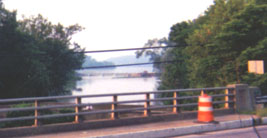 Heading into New Brunswick, near the
Rutgers School of Medicine and Dentistry, I cross a bridge over a calm river.
Soon the shoulder becomes wider and I begin to pass through farmland. Early
morning fog hangs over wide, flat fields punctuated by tiny farmhouses. I stop
to eat half a sandwich and a couple of Hershey bars. My breakfast in the city
seems far away already.
Heading into New Brunswick, near the
Rutgers School of Medicine and Dentistry, I cross a bridge over a calm river.
Soon the shoulder becomes wider and I begin to pass through farmland. Early
morning fog hangs over wide, flat fields punctuated by tiny farmhouses. I stop
to eat half a sandwich and a couple of Hershey bars. My breakfast in the city
seems far away already.
In Kingston, about three miles outside of Princeton, I cross the Delaware
Raritan Canal. It's about 7am, and the Princeton crew team are practising on
the canal to my left.
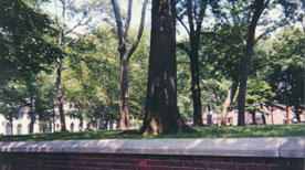
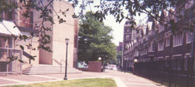
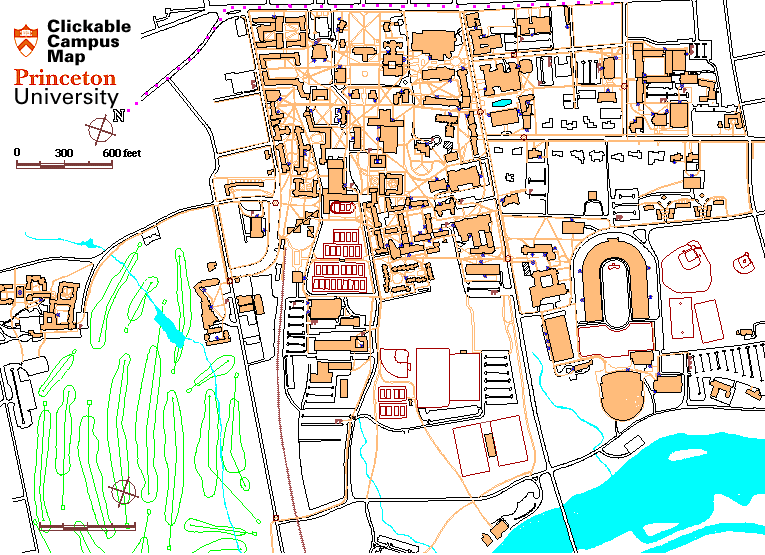
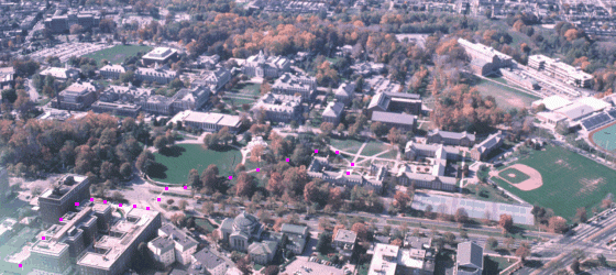
I cut through the Princeton University campus 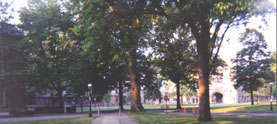 and turn onto the 583 (Mercer
Street) which is a half left from the 27 (Nassau Street) within sight of the
monument. Along most of Mercer Street a cycleway runs along the side of the
road. Heading into Lawrence Township, Mercer Street becomes Princeton Pike.
There's a morning rush on the other side of the road but not much traffic going
my direction. The drivers seem bicycle-friendly, probably because this place
is so close to a university town. This is fortunate, because the shoulder is
very narrow here. Although there's a wide expanse of grass to my right, it's
too soft to ride on. I cross the 95, and then the 206. (The 206 and the 583
from Princeton actually end up in the same place here, although the 583 takes a
more direct route.)
and turn onto the 583 (Mercer
Street) which is a half left from the 27 (Nassau Street) within sight of the
monument. Along most of Mercer Street a cycleway runs along the side of the
road. Heading into Lawrence Township, Mercer Street becomes Princeton Pike.
There's a morning rush on the other side of the road but not much traffic going
my direction. The drivers seem bicycle-friendly, probably because this place
is so close to a university town. This is fortunate, because the shoulder is
very narrow here. Although there's a wide expanse of grass to my right, it's
too soft to ride on. I cross the 95, and then the 206. (The 206 and the 583
from Princeton actually end up in the same place here, although the 583 takes a
more direct route.)
Coming into Trenton, traffic begins to pick up, and there's a sign for county
route 653, a diagonal road that shoots off to the right. The name of this road
is Calhoun Street, and it leads directly to the bridge over the Delaware River
 into Pennsylvania. (If you make the mistake of continuing stright rather than
veering right, you'll find yourself on Martin Luther King Junior Boulevard, and
you should cut to the right to get onto Calhoun Street.) Near the bridge,
Calhoun Street leads into a roundabout. Follow the signs for route 29 toward
Morrisville to get onto the bridge. A sign says 'CARS ONLY', but bicycles are
allowed if you walk them on the footpath on the northern side of the bridge.
into Pennsylvania. (If you make the mistake of continuing stright rather than
veering right, you'll find yourself on Martin Luther King Junior Boulevard, and
you should cut to the right to get onto Calhoun Street.) Near the bridge,
Calhoun Street leads into a roundabout. Follow the signs for route 29 toward
Morrisville to get onto the bridge. A sign says 'CARS ONLY', but bicycles are
allowed if you walk them on the footpath on the northern side of the bridge.
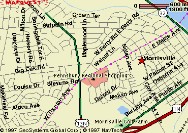
In Langhorne, Trenton Road becomes Lincoln Highway. At about nine o'clock, I
stop for a quart of chocolate milk. After a long series of strip malls and
car dealerships, Lincoln Highway veers left and becomes an expressway, and Old
Lincoln Highway continues straight. I take Old Lincoln Highway, and begin
thinking about finding someone from whom to ask directions, since I think I may
have missed the turn onto Hulmeville Road. A bit past Bensalem, I stop at a
car dealership. The guy washing cars in the lot tells me how to get into
Philadelphia. `Remember to drink a lot of water!' he shouts as I pull away.
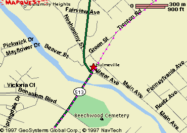
I turn left just past the car dealership onto the 132 east (Street
Road), and pass through Nottingham. I turn right onto the 513 (Hulmeville
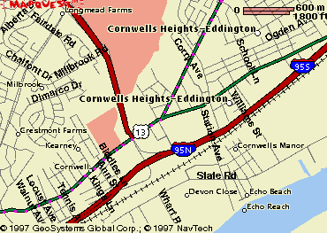
Road). At the end of the 513 I turn onto the 13 south and enter the village of
Andalusia. The 13 becomes Frankford Road as it enters the city of
Philadelphia. I pass another bike shop on the right, and stop at an A-plus for
a huge cup of soda. The people there are kind of freaked out that I'm
bicycling from New York to Baltimore, especially in such hot weather.
An elevated railway shades me from the midday sun as I continue south on
Frankford Road.
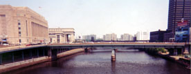
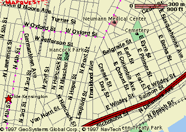
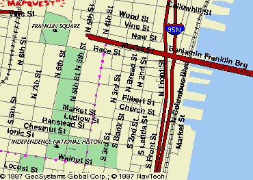
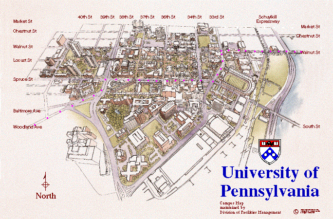
In downtown Philadelphia I head west a few blocks, then south
again, then west on Walnut Street past Independence Hall, and across the river
onto the University of Pennsylvania campus. In West Philadelphia a whole
neighbourhood is clustered around an open hydrant, and I fill my water bottle
and duck my head under the flow. `There's plenty of water for everybody!'
announces a man with a wrench who's been opening the hydrants. He has just
become the most popular person in his neighbourhood.
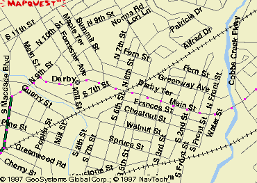
From the University of Pennsylvania, Woodland Avenue leads
southwest and becomes Main Street in Darby after crossing Cobbs Creek. I turn
left onto 9th Street and then left onto route 13 south again. It's 1.30pm and
the temperature shown on a bank sign is 101 degrees.
On the 13 south of Philadelphia, I stop at a deli for a sandwich. I feel
lethargic and lightheaded and know I should eat, even though I'm not hungry.
In this heat I can't bring myself to get back on the bike right away, so I
lie in the shade for an hour.
Chester, the southernmost town in Pennsylvania, is run-down and abject.
Continuing straight on the road that I assume to be the 13, I run into
a dead end. I stop at a garage to ask directions, and the mechanic tells me
from behind a locked gate that I need to head west on 9th Street to get to the
13. (On a route without the detour that I made, this would be a right turn
from the road that leads through Chester.) `Don't pedal too slowly through
Chester', he advises, `you're in a bad neighbourhood.' I head west on 9th
Street and eventually see a sign telling me that I'm back on the 13 south.
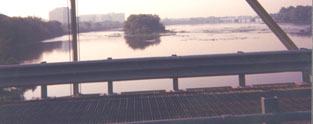
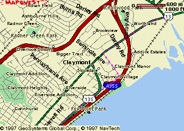
Heading south into Delaware, I can see the painted steel of Delaware Bay Bridge
rising on my left, over a yard full of oil storage tanks. A few miles into
Delaware, I turn left toward the river in order to avoid the hills on the way
into Wilmington. I pass several motels, but I want to get past
Wilmington before stopping for the day.
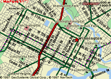
I turn right on 4th Street in Wilmington. Most of this road through the city
is uphill, and I'm tired. Eventually I make it to the 2 south, and
turn left to head out of Wilmington. The 2 between Wilmington and Newark is a
series of strip malls, fast food restaurants, and the like. I don't see a
single motel. On the outskirts of Newark I stop at a convenience store for a
Gatorade, and ask a local couple if there are any places to stay nearby.
They're impressed that I've come from New York in one day. `I can't even drive
my car that fast!' says the lady. They point me to a TraveLodge which turns
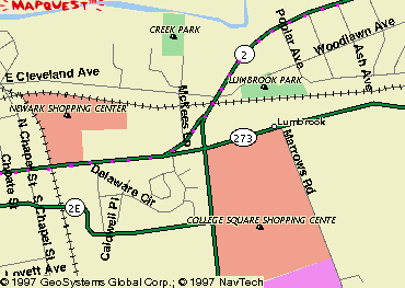
out to be right on my route, just after the 273 veers off to the right of the 2
in Newark. I phone my family to tell them where I am, take a shower, and fall
into bed.
 The next morning I start at 6.40am, after a second shower and a couple of
sandwiches and sodas. I pass a bike shop on the 273, just a few blocks from
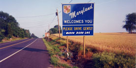
the TraveLodge. It's not far from here to the Mason-Dixon Line. From that
point I have only three counties in Maryland to traverse before arriving in
Baltimore. But Cecil County and eastern Harford County are a series of hills,
some of which seem to go on forever. I labour up them and coast down, the seat
digging into me. At the eastern edge of Cecil County I cross the Susquehanna
River;
The next morning I start at 6.40am, after a second shower and a couple of
sandwiches and sodas. I pass a bike shop on the 273, just a few blocks from
the TraveLodge. It's not far from here to the Mason-Dixon Line. From that
point I have only three counties in Maryland to traverse before arriving in
Baltimore. But Cecil County and eastern Harford County are a series of hills,
some of which seem to go on forever. I labour up them and coast down, the seat
digging into me. At the eastern edge of Cecil County I cross the Susquehanna
River; 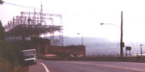 the road runs across the top of
a hydroelectric station. There isn't much around here. I stop every ten miles
or so at small-town stores and buy Gatorade or All-Sport. Eventually
the 273 merges into the 1. In Perry Hall, a Harford County suburb of
Baltimore, I stop for a sandwich. The air-conditioned restaurant is welcome
relief from the heat of the road.
the road runs across the top of
a hydroelectric station. There isn't much around here. I stop every ten miles
or so at small-town stores and buy Gatorade or All-Sport. Eventually
the 273 merges into the 1. In Perry Hall, a Harford County suburb of
Baltimore, I stop for a sandwich. The air-conditioned restaurant is welcome
relief from the heat of the road.
I must have missed a turn in Baltimore, because after continuing on the 1 I
find myself downtown. (A note for the future: Harford Road, which branches off
the 1, looks like a more direct and less confusing route into northern
Baltimore. It intersects 33rd Street near Lake Montebello.)
I turn north onto Charles Street. About twenty blocks
south of Johns Hopkins University, my final destination, some of the worst
muscle pain I've ever felt hits my left leg. I half fall off the bike, and
lean against the kerb. I stare at my leg in disbelief; it looks and feels as
if someone's tying knots in the muscle. I sit there for about ten minutes and
then gingerly walk the last twenty blocks to the campus. There, a cramp hits
my other leg as I'm walking up some stairs. But I'm done. I've covered
about a hundred eighty miles in two days, making up with persistence what I
probably lacked in skill. All I need to do now is take it easy.
(maps illustrate congested areas and critical turns)
- New York
- New Jersey
- Pennsylvania
- Delaware
- Route 13 to Claymont
- at hilltop traffic signal just south of the Delaware border, turn left onto the riverside route, proceed into Wilmington
- Route 2 to Newark
- Maryland

Interactive Mapping by MapQuest